Political Geography
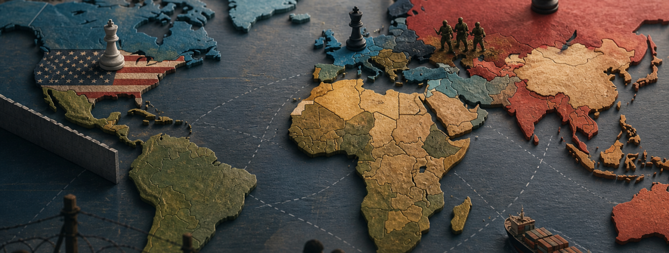
Political geography is a vital field of study. it looks at how power and earth connect. This branch of science asks how humans divide the world. It explores how we draw lines on maps. These lines often show where one law ends and another begins. The field covers many things. It looks at small towns and big empires. It looks at how people feel about their land. By studying this field, we learn how history and space work together. We see how the shape of the land affects the way leaders think. This article will look at the main ideas in political geography. It will show why this study matters today.
The roots of this field go back a long time. Early thinkers wanted to know how land helped a nation grow. They saw the state as a living thing. This idea was common in the late nineteenth century. Some believed that a state must grow to stay strong. They thought that states needed more space to thrive. This led to many big changes in the world map. It helped explain why some nations sought to gain more land. These early ideas were simple but very strong. They shaped how people saw war and peace for many years.
The Evolution of Modern Geopolitics
As time went on, the field grew more complex. New theories began to emerge about world power. One famous theory looked at the center of the earth. This area was called the Heartland. The idea was that who rules the Heartland rules the world. This theory focused on the big land mass of Europe and Asia. It suggested that sea power was not the only way to lead. Land power was just as vital. This way of thinking changed how big nations planned their moves. It made the center of the continent a key prize for any great power.
Later, other thinkers looked at the edges of the land. They called these areas the Rimland. They argued that the edges were the key to global control. This shift showed that geography is not just about one spot. It is about how different spots link to each other. These ideas were used during many large conflicts. They helped leaders decide where to build bases. They helped them choose which nations to support. Today, we still see these ideas in action. Modern states still worry about who controls the main trade routes on land and sea.
The Role of the State and Sovereignty
The state is the most basic unit in political geography. A state is a group of people with their own government and land. To be a state, a group needs a clear space. This space must have borders that others respect. This lead to the idea of sovereignty. Sovereignty means that a state has the final say over its own land. No other state should tell it what to do inside its borders. This idea keeps the world order stable. It helps prevent constant fights over who is in charge. However, this rule is not always easy to follow. Some states face challenges from the inside and the outside.
Borders are more than just lines. They can be tall walls or simple marks on the ground. Some borders follow natural things like rivers or mountains. These are called physical borders. Other borders are straight lines drawn by people. These are called geometric borders. Both types of borders change how people live. They affect who can visit and who can work. They also change how resources like water and oil are shared. A border can be a place of trade or a place of conflict. It is a key part of how a state keeps its identity. Without a border, a state may lose its sense of self.
Globalization and the Changing Map
In the modern world, the map is changing fast. Globalization is a big reason for this change. It connects people across long distances. Money, goods, and ideas move faster than ever before. This makes some borders feel less important. For example, some groups of states work together as one. They share the same money and let people move freely. This is called supranationalism. It shows that states can give up some power to gain more wealth and peace. This trend challenges the old idea that every state must stand alone. It creates a new kind of political space.
At the same time, some states are breaking into smaller parts. This is called devolution. This happens when a group of people in a region want more power for themselves. They may feel that the central government does not hear them. They may have a different culture or language. This can lead to the birth of new states. It shows that the map is never truly finished. It is always moving and shifting. Political geography helps us track these changes. It helps us see why some regions stay together and why others pull apart. This keeps the field very busy and useful.
Power in the Digital Age
Today, power is not just about land. It is also about the digital world. The internet has no physical borders. Information can travel around the world in a second. This creates new problems for political geography. How does a state rule a space it cannot see? Digital power can influence how people vote and think. It can even affect the economy of a nation. Some call this the end of distance. But land still matters. The wires and servers that run the internet must sit on someone’s land. This means that physical space and digital space are now linked. Leaders must now guard both their soil and their data.
Soft power is another key part of modern life. This is the power to lead by example rather than by force. It involves culture, values, and laws. A state with strong soft power can win friends without using its army. This type of power is hard to map but very real. It spreads through movies, books, and trade. Political geography now looks at how these things flow across the globe. It studies how a nation’s image affects its place in the world. This shows that the field is much more than just studying rocks and dirt. It is about the human spirit and how we connect.
Conclusion
Political geography is a rich and diverse field. It helps us make sense of a complex world. We have seen how land shapes power and how power shapes land. From the early days of organic states to the new era of digital flows, the field has grown. It tells the story of how we live together on one planet. It teaches us that borders are both real and imagined. It reminds us that while we are divided by lines, we are linked by trade and ideas. As the world moves forward, this study will remain vital. It will continue to provide the tools we need to navigate the global stage. By looking at the map, we see the past, the present, and the future of human life.
Sources:
Agnew, J. (2014). Geopolitics: Re-visioning world politics. Routledge.
Flint, C. (2021). Introduction to geopolitics (4th ed.). Routledge.
Glassner, M. I., & de Blij, H. J. (2004). Systematic political geography. Wiley.
Painter, J., & Jeffrey, A. (2009). Political geography: An introduction to space and power. SAGE Publications.