
When the Earth Trembles: Understanding Philippine Earthquakes and Our Solar System
The Seismic Landscape of the Philippines
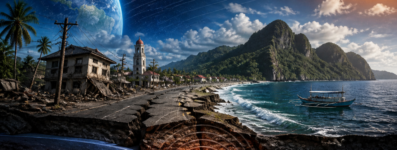
The Philippines is a large group of islands in Southeast Asia. It sits in a very active part of the world. This area is the Pacific Ring of Fire. This name describes a path along the Pacific Ocean where many earthquakes happen. Most of the world’s volcanic eruptions also occur here. For the people of the Philippines, the shaking of the ground is a common part of life. Understanding why the Earth trembles is vital for safety. It is also a key part of modern earth science. Researchers look at both local and global factors to explain these events. They study the deep parts of the ground and the stars above. This article will look at the forces that shape the land. We will also see how the solar system might play a small role in these events.
The Philippine Fault Zone
The main cause of earthquakes in this region is the movement of tectonic plates. These are large slabs of the Earth’s outer shell. They float on a softer layer of hot rock below. In the Philippines, several plates meet and push against each other. The Philippine Fault Zone is one of the most famous features. It is a long crack in the ground that runs through the whole country. It is more than one thousand kilometers long. This fault moves sideways. When the rocks on either side of the fault get stuck, pressure builds up. When the rocks finally break or slip, energy is released. This energy travels through the ground as waves. These waves are what we feel as an earthquake. The fault zone is very active and has caused many large quakes in the past century.
Subduction Zones and Trenches
There are also areas called subduction zones near the islands. In these spots, one tectonic plate slides under another. The Philippine Trench and the Manila Trench are two examples. As the plate sinks into the Earth, it creates deep holes in the ocean floor. This process is not smooth. The plates grind against each other with great force. This grinding can cause very deep and very strong earthquakes. These underwater quakes are also the main cause of tsunamis. A tsunami is a giant wave that can hit the coast after the ground shakes. Scientists monitor these trenches very closely. They use special tools to measure the speed of the plates. Even though the plates move only a few centimeters a year, the power they hold is immense. This power can change the shape of the islands over thousands of years.
The Influence of the Solar System
Earth is not a lonely rock in space. It is part of a large solar system. Other objects in space can have an effect on our planet. Some people ask if the Moon or the Sun can cause earthquakes. This is a topic that many scientists study today. While the main cause of quakes is plate movement, outside forces might act as a trigger. This means they could help a quake start if the pressure is already very high. We must look at gravity and radiation to understand this link. It is a complex field of study that combines geology and astronomy. By looking at the sky, we might learn more about the ground beneath our feet. This connection shows how everything in nature is linked together.
Lunar Tides and the Earths Crust
The Moon is our closest neighbor in space. We know that the Moon’s gravity pulls on the oceans. This pull creates the tides that rise and fall every day. However, the Moon does not just pull on the water. It also pulls on the solid Earth. This is called a terrestrial tide. The ground can actually rise and fall by a few centimeters. Most people cannot feel this movement. Some researchers think this pull can put extra stress on fault lines. During a full moon or a new moon, the Sun and Moon line up. This makes the gravitational pull much stronger. Some studies suggest that big earthquakes happen more often during these times. While the Moon does not create the fault, it might give it the final nudge needed to slip. This is still a theory that needs more data to prove fully.
Solar Activity and Magnetic Fields
The Sun is the center of our solar system and gives us light. It also sends out a stream of particles called the solar wind. Sometimes, the Sun has large explosions called solar flares. These flares send a lot of energy toward Earth. This energy hits the magnetic field that protects our planet. Some scientists believe that this energy can affect the Earth’s crust. They look at how magnetic changes might lead to more seismic activity. There is a lot of debate about this in the scientific world. Some think the link is very weak. Others think it is an important piece of the puzzle. Studying the Sun helps us understand the many ways energy enters our world. It shows that the Earth is sensitive to the weather in space. This research is part of a new field called helioseismology.
Historical Seismic Events in the Region
The history of the Philippines is full of stories about the Earth moving. These events stay in the memory of the people. They also provide data for scientists to study. By looking at the past, we can prepare for the future. Each major quake teaches us about the faults and how they behave. We learn which areas are at high risk. We also learn how to build better houses and buildings. History is a great teacher for those who live in the Ring of Fire. These events show the true power of the Earth. They remind us that we must respect the forces of nature. We will now look at two specific examples from recent history.
The 1990 Luzon Earthquake
In July 1990, a very strong earthquake hit the island of Luzon. It had a magnitude of 7.7 on the Richter scale. The shaking lasted for about one minute. It caused a huge crack in the ground that was 125 kilometers long. Many buildings fell down in cities like Baguio and Cabanatuan. This event was a major turning point for the country. It led to stricter rules for building structures. It also showed the need for better rescue teams. People learned how important it is to have an emergency plan. The 1990 quake is still one of the most famous seismic events in Philippine history. It proved that the Philippine Fault System is a major threat to the nation. Scientists used the data from this quake to map out dangerous zones across the island.
The 2013 Bohol Earthquake
In October 2013, the island of Bohol was hit by a magnitude 7.2 earthquake. This quake was unique because it was caused by a new fault. Before this event, scientists did not know this specific fault existed. The energy released was equal to many atomic bombs. It destroyed old churches that had stood for hundreds of years. It also changed the landscape of the island. Some parts of the ground rose up by three meters. This event taught us that the Earth can still surprise us. Even with modern tools, there are hidden faults that we have not found yet. It highlighted the need for more geological surveys across all the islands. The Bohol quake showed that every part of the country must be ready for a sudden tremor.
The Importance of Monitoring and Safety
Since we cannot stop earthquakes, we must learn to live with them. This starts with good monitoring. The government has an agency called PHIVOLCS. They use sensors to listen to the Earth. These sensors are spread out all over the country. They can detect even the smallest vibrations. When a large quake happens, they give out information quickly. This helps people know what to do and where to go. Modern technology makes this much easier than in the past. We now have apps and websites that show earthquake data in real time. Education is also a big part of safety. Schools and offices have regular earthquake drills. These drills teach people how to protect themselves. This is known as the “drop, cover, and hold on” method. These simple steps can save many lives during a disaster.
Technological Advancements
New tools are helping us understand the Earth better. Satellites in space can now see small changes in the ground. They use lasers and radar to map the surface. This helps scientists see where the ground is swelling or sinking. We also have better computer models. These models can simulate how a quake might spread through a city. This helps engineers design buildings that can sway without falling. Some researchers are even looking at how smart phones can be used. The sensors in a phone can act like a mini seismograph. In the future, millions of phones could work together to form a giant warning system. This shows how human logic and tech can help us stay safe. We are moving toward a world where we are more aware of the Earth’s movements.
Conclusion
The Philippines will always be a land of beauty and a land of tremors. Its place on the Ring of Fire means that the Earth will keep moving. These quakes are caused by the slow dance of tectonic plates. While we look at the ground, we must also look at the sky. The Sun and Moon exert forces that may play a role in seismic timing. By studying both the Earth and the solar system, we get a full picture of our world. History has shown us that being prepared is the best defense. We have learned from the quakes of the past to build a safer future. Science continues to give us the tools we need to understand these giant forces. In the end, we are all part of a dynamic and changing planet. Respecting and studying the Earth is the key to our survival. We must continue to watch, learn, and prepare for the next time the ground begins to shake.
Aurelio, M. A. (2000). Tectonics of the Philippines revisited. Journal of the Geological Society of the Philippines, 55(3/4), 119-133.
Hutton, L. K., & Woessner, R. L. (2015). Introduction to Seismology. Cambridge University Press.
Lagmay, A. M. F., & Eco, R. (2014). The 2013 Bohol Earthquake: A case study of a hidden fault. Philippine Journal of Science, 143(2), 149-160.
National Aeronautics and Space Administration. (2022). Solar activity and its effects on Earth. NASA Science Communications.
Philippine Institute of Volcanology and Seismology. (2021). The Philippine Fault System and its activity. Department of Science and Technology.
United States Geological Survey. (2023). Earthquakes and the Moon: Exploring the connection. USGS Earthquake Hazards Program.